- ISRO’s GSLV-F16 rocket successfully launched the NISAR satellite into sun-synchronous orbit.
- NISAR is the world’s first radar satellite to use dual-band synthetic aperture radar.
- The mission is a landmark in Indo-US space cooperation and open-access climate monitoring.
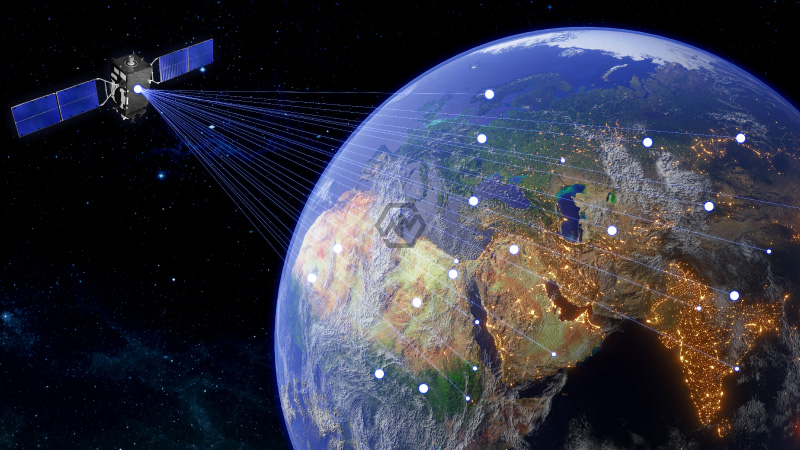
India marked a major milestone in international space collaboration with the successful launch of the NASA-ISRO Synthetic Aperture Radar (NISAR) satellite from Sriharikota on July 30, 2025.
The satellite is designed to provide crucial data on land deformation, ecosystem disturbances, ice movements, and natural disasters. With its L-band (NASA) and S-band (ISRO) radars, NISAR is uniquely equipped to deliver high-resolution imagery regardless of weather or daylight.
NISAR Launch Marks New Era in Global Earth Observation and Indo-US Space Alliance
NISAR is a result of more than a decade of joint effort between ISRO and NASA, backed by a combined investment of over $1.5 billion. Its dual-frequency capability, powered by a 12-meter deployable antenna, enables it to detect shifts on the Earth’s surface as small as a centimeter. This level of detail is critical for understanding geophysical phenomena such as earthquakes and glacier dynamics, offering early insights for potential disasters.
This launch represents ISRO’s 102nd mission from Sriharikota and is the first to deploy a radar-based Earth observation satellite using a GSLV. Traditionally, such missions have relied on PSLV launchers, making GSLV-F16’s role a significant expansion of ISRO’s operational profile. This move also aligns with India’s ambition to become a key contributor to global environmental monitoring and mitigation strategies.
One of NISAR’s defining features is its open-data policy. Unlike many Earth observation missions that restrict access to data, NISAR’s observations will be made publicly available within one to two days. In case of emergencies, near real-time data will be prioritized, offering a crucial edge to countries lacking advanced space infrastructure, especially during climate events and humanitarian crises.
Scientists anticipate that NISAR’s consistent and detailed data will revolutionize the way governments, researchers, and environmental organizations respond to global challenges. Whether it’s monitoring crop health, tracking storm paths, or analyzing soil moisture shifts, the satellite’s sweeping view of the Earth offers actionable intelligence to aid sustainable development and resource management.
The successful launch of NISAR is not only a technological triumph but a testament to what global partnerships can achieve in pursuit of a safer, more informed planet.
“Science knows no country, because knowledge belongs to humanity, and is the torch which illuminates the world.” — Louis Pasteur
