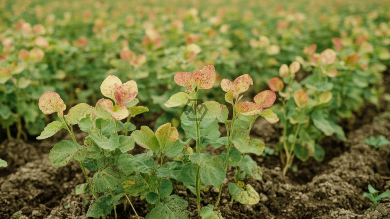
- University of Illinois drones detect soybean damage from dicamba vapor at extremely low doses.
- Technology identifies crop stress invisible to the human eye just eight days after exposure.
- Study offers a data-driven solution to monitor herbicide drift and assist regulatory decisions.
Researchers at the University of Illinois Urbana-Champaign have developed a precision drone system that can detect soybean canopy damage from dicamba herbicide exposure—down to one ten-thousandth of its labeled application rate.
Led by doctoral student Dylan Kerr and crop sciences expert Dr. Aaron Hager, the study confirms that remote sensing can distinguish between subtle dicamba damage and healthy or tolerant plants.
How Drones Are Redefining Herbicide Drift Detection in Soybeans
The drone-mounted sensors were calibrated to detect damage at four exposure levels, mimicking both vapor and particle drift scenarios. These ultra-low rates replicate real-world cases where surrounding crops suffer collateral damage from neighboring fields. The ability to detect injury at such microscopic concentrations is crucial for early intervention and crop protection.
This innovation responds to long-standing concerns among farmers and environmental agencies who have lacked a consistent method to measure off-target dicamba effects. Until now, damage assessments relied heavily on anecdotal complaints or visual symptoms, which often appear too late or go unreported due to fear of conflict. The drone system provides a neutral, science-based solution to fill this gap.
Co-author Marty Williams emphasized the importance of unbiased public research in advancing agricultural accountability. “We’re not here to push policy,” he said. “Our goal is to build tools that answer hard questions with data, not speculation.” With accurate records, affected growers can advocate for themselves more effectively, while policymakers gain a clearer picture of herbicide impact.
Beyond soybean fields, the researchers aim to expand the application of this technology to assess potential harm to trees, residential landscapes, and pollinator habitats. The team is also experimenting with satellite imaging to scale this process, enabling region-wide monitoring without the need for manual inspections.
By turning drones into early-warning tools, this research bridges the gap between field-level observations and regulatory oversight—empowering agriculture with clarity from above.
“Science is the great antidote to the poison of enthusiasm and superstition.” – Adam Smith
